
- A thousans years of Jeolla-do
- The Birth of Cheolligil
- Cheolligil’s BI
- Categories within JeonBuk Cheolligil
Jeolla-do used to
be called Honam.
The name Honam is said to be given because it is at the southern part of Byeokgolje, the first artificial reservoir in the Korean Peninsula. Another theory is that it was named so because it is located south of the Ho river, which is currently known as the Geum river.
The name derives from Jeonju and Naju which originates from the district names that have existed since the Goryeo era. Jeolla-do has retained its name for 1,000 years and has many stories and cultures in its long history and is remembered as the "hometown of Korean hearts."
Jeollabuk-do has been receiving the spotlight as a place that encompasses the unique historical and cultural values of Korea even since the province was divided into two parts during the Korean republic.
Geographically, its neighbors include Hadong, Hamyang, Geochang, and Gimcheon at the southeast side and Yeonggwang, Jangseong, Damyang, Gokseon, and Gurye to the south.
At its north it is below Geumsan, Nonsan, Buyeo, Secheon and Yeongdong.
It is also a global hub for international trade as it is connected to China.
Keep an eye out for Jelloabuk-do
which is coming up anew through
its millennium-long legacy.
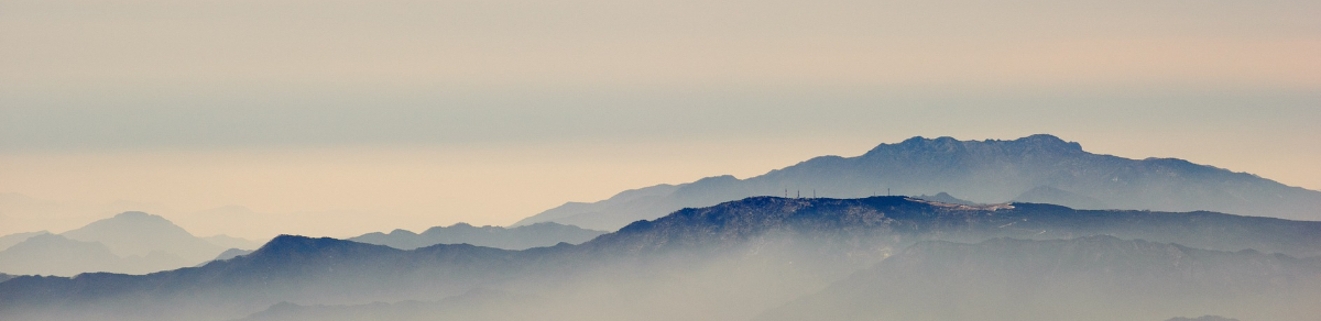
In addition it is surrounded by miraculous mountains such as the Jiri, Moak, Deokyu, and Unjang. The region is also near the west coast, a place that is affluent with unlimited ecological value and home to myriads of sea creatures. The coast also offers the plains of the horizon and illustrates the vastness of nature.
Keep an eye out for Jelloabuk-do which is coming up anew through its millennium-long legacy. From its rich historical backgrounds it will rise up as a region with a prosperous future.
Masterpiece road
of Jeollabuk-do
Amid the rise of backpacking, numerous streets and trails embody different sceneries and narratives to entice travelers.
During the process of exploring these streets, we are not merely walking as a means of exercise or to get a good view but we engage ourselves with the region’s historical and cultural values as we look into the lives of the natives.
We like to refer to the trails that satiate such desires as masterpieces.
In Jeollabuk-do there is a variety of masterpiece trails that
do not pale in comparison to those within any other place within the country.
As you walk along the west coast you are able to view the beautiful sunset illustrated by nature. In addition you can walk around one of the most titular landmarks in Korea, which is Mt. Jiri. Within Naejang Mountain you can enshroud yourself within the autumn leaves where you can look at the scenery from a traditional korean folk song in which a wife waits for her husband.
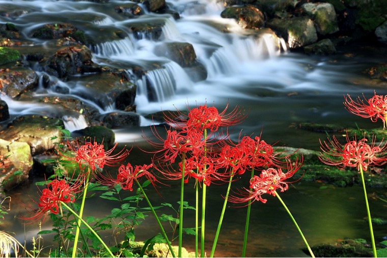
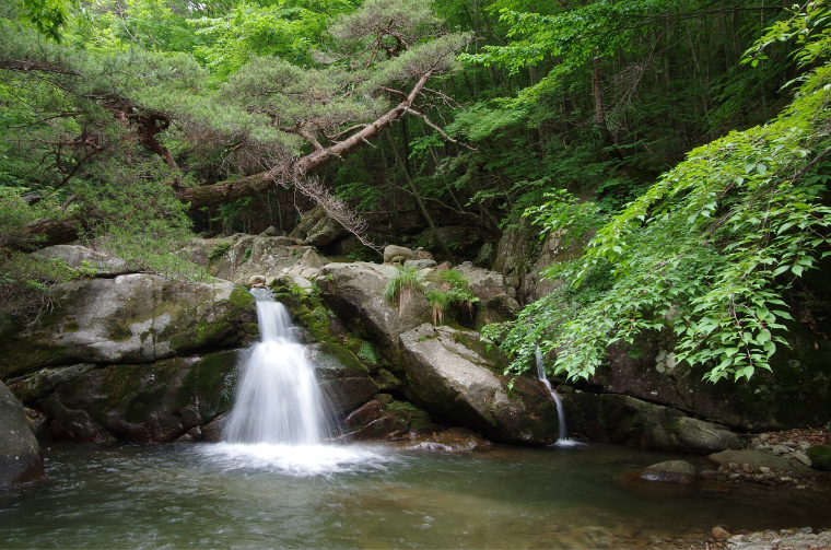
You can rise the mountains and reach the waterfalls where masters of traditional singing practiced their craft and rise up to the plains while listening to the songs of the winds.
You can walk along the Seomjin river and Geum river where the river’s beauty blooms within the mist. You can also visit the wetlands that have been recognized internationally for its ecological significance.
Now let’s set off on your journey.
Like so, we picked a handful of masterpiece trails that are rich with aesthetics and historical value. Fourteen cities have picked three to four trails and they have been named as <JeonBuk Cheolligil>.
Each trail is categorized depending on its location and they may take two to three hours while some of the lengthier ones take up to six hours. Feel free to indulge yourself in the various qualities Jeollabuk-do has to offer.
Now let’s set off on your journey. New encounters await us. Every trail within the province is rich with scenery and narrative that we otherwise would not be able to enjoy. Enjoy the relaxation and leisure that you have longed for.
We welcome you on your first steps in the journey to <JeonBuk Cheolligil>.
Walk the millennium in Jeollabuk-do,
JeonBuk Cheolligil
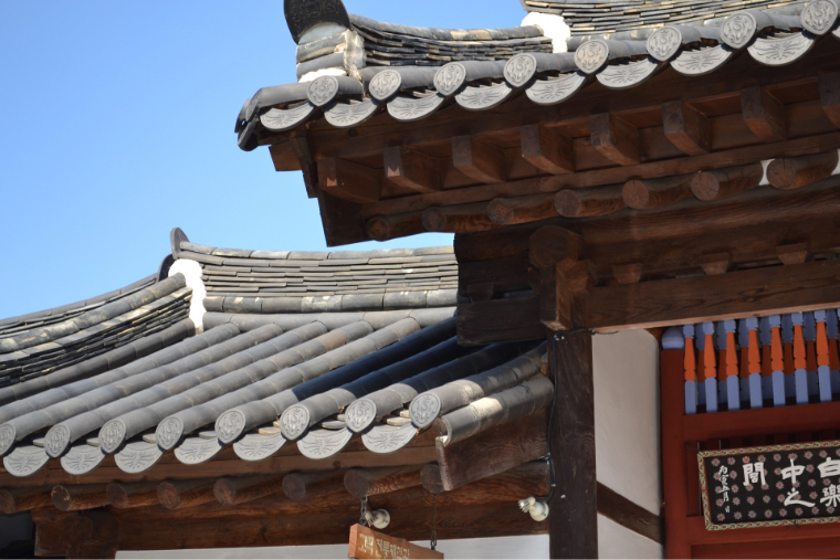
The logo for the Jeonbuk Cheolligil resembles the Hanok, which is the traditional Korean architecture, since Jeonbuk is known to be the home of traditional history and culture.
Under the stable roof the four themes of Jeonbuk Cheolligil which includes mountain paths, seasides, riversides and lake trails are included in the imagery.
The green mountains and plains, the vast blue see and the yellow scenery as well as the setting sun is depicted within the logo.
Color System
-
Cheolligil Navy
HEX #01458c
CMYK C100, M87, Y27, K0
RGB R1, G69, B140 -
Cheolligil Green
HEX #98c537
CMYK C49, M7, Y90, K0
RGB R152, G197, B55 -
Cheolligil Blue
HEX #038cd0
CMYK C80, M37, Y5, K0
RGB R3, G140, B208 -
Cheolligil Yellow
HEX #f8c300
CMYK C7, M29, Y91, K0
RGB R248, G195, B0 -
Cheolligil Red
HEX #d9072c
CMYK C18, M100, Y85, K0
RGB R217, G7, B44
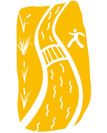
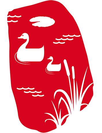
Categories within JeonBuk Cheolligil
JeonBuk Cheolligil is categorized according to four themes. Each scenery offers different characteristics and may vary in length and the time needed to complete the trails. Please enjoy different trails according to your itinerary.
-
Mountains and Hills Road
Coastal Road
Riverside paths
Lake paths

Mountains and Hills Road
The great mountains of Jeollabuk-do and large field surrounding it, It is the way to meet the villages hidden in the scenery.
| Name of Trail | Length of Course | Estimated Time | Difficulty |
|---|---|---|---|
| Jeonju Haok-maeul Dullae-gil | 8km | 2hrs 30mins | Easy |
| Jeonju Cheonnyeon Jeonju Masil-gil | 12km | 5hrs 30mins | Normal |
| Jeonju Geonjisan-gil | 9km | 4hrs | Easy |
| Gunsan Gubul 6-1-gil (Takryu-gil) | 3km | 1hrs | Easy |
| Iksan Mireuksandullae-gil | 8km | 2hrs 30mins | Easy |
| Jeongeup Jeongeupsa Osol 1-gil | 8km | 2hrs 30mins | Normal |
| Jeongeup Daejanggeum Masil-gil | 5km | 2hrs | Easy |
| Namwon Jirisandullaegil 1 (Gooryongpo) | 14km | 5hrs 30mins | Hard |
| Namwon Jirisandullaegil 2 | 11km | 4hrs | Normal |
| Namwon Goryongsandullae-gil | 8km | 3hrs | Easy |
| Gimje Geum-gu Myeongpoom-gil | 11km | 4hrs | Normal |
| Gimje Geumsansa-gil | 13km | 5hrs | Hard |
| Wanju Gojongmasil-gil | 11km | 4hrs | Hard |
| Wanju Eunmoongol Masil-gil | 6km | 2hrs | Easy |
| Wanju Wanju Pyunbaeksup-gil | 6km | 2hrs 30mins | Easy |
| Jinan Maisan-gil | 8km | 3hrs 30mins | Normal |
| Muju Gucheondongeosa-gil | 13km | 4hrs | Normal |
| Jangsoo Banhwadong Saengtae-gil | 10km | 4hrs | Normal |
| Jangsoo Ddeungbongsaem Saengtae-gil | 4km | 2hrs | Easy |
| Jangsoo Jangsoomasil-gil | 11km | 4hrs 30mins | Normal |
| Soonchang Gangcheonsan-gil | 7km | 2hrs 30mins | Easy |
| Soonchang Seonbi’s-gil | 6km | 2hrs 30mins | Easy |
| Gochang Eungok Wetland Saengtae-gil Course no.1 | 5km | 1hrs 30mins | Easy |
| Gochang Eungok Wetland Saengtae-gil Course no.2 | 10km | 3hrs 30mins | Normal |
| Gochang Gochangeupseon-gil | 13km | 4hrs | Normal |
*Time needed for the completing of each trail might vary depending on detours travelers take as well as the pace and speed of the individual traveler.
*Please confirm your transport details plan accordingly.

Coastal Road
These trails are located on the west coast of the Korean peninsula. The beautiful scenery created by the vast mud flats as well as the sunset that gleams on top of it.
| Name of Trail | Length of Course | Estimated Time | Difficulty |
|---|---|---|---|
| Gunsan Gubul 8-gil | 10km | 3hrs 30mins | Easy |
| Gimje Saemangeum Baram-gil | 12km | 4hrs | Normal |
| Buan Jeokbyuk-gang Noeul-gil | 10km | 4hrs | Normal |
| Buan Haenum Esol-seom-gil | 6km | 2hrs 30mins | Easy |
| Buan Mohang-Gaetbul-gil | 5km | 2hrs | Easy |
| Buan Ssanggaejae | 7km | 2hrs 30mins | Easy |
*Time needed for the completing of each trail might vary depending on detours travelers take as well as the pace and speed of the individual traveler.
*Please confirm your transport details plan accordingly.
Riverside paths
Natural rivers such as the Geum river and Seomjin river are not only ecologically rich but are affluent with beautiful scenery.
| Name of Trail | Length of Course | Estimated Time | Difficulty |
|---|---|---|---|
| Iksan Hamra-san Dullae-gil | 12km | 4hrs 30mins | Normal |
| Iksan Eungpogomgaenaroo-gil | 21km | 8hrs | Hard |
| Jinan Unilambanilam-forest-gil | 10km | 3hrs 30mins | Normal |
| Muju Yehyangcheonri Geumgangmasil-gil course no.2 | 10km | 3hrs | Easy |
| Muju Yehyangcheonri Geumgangmasil-gil course no.1 | 7km | 3hrs | Easy |
| Imsil Seomjingang-gil | 11km | 4hrs | Normal |
| Soonchang Janggunmok-gil | 9km | 3hrs 30mins | Easy |
*Time needed for the completing of each trail might vary depending on detours travelers take as well as the pace and speed of the individual traveler.
*Please confirm your transport details plan accordingly.
Lake paths
Okjeong lake, and Nejang reservoir offer a cryptic scenery early morning with mist. Try walking through the narrow trails within the mystic mist.
| Name of Trail | Length of Course | Estimated Time | Difficulty |
|---|---|---|---|
| Gunsan Gubul 4-gil (Guseulmoe) | 9km | 3hrs 30mins | Easy |
| Gunsan Gubul 5-gil (Mulbit-gil) | 9km | 3hrs 30mins | Easy |
| Jeongeup Jeongeup-sa Osol-gil Course no. 2 | 6km | 1hrs | Easy |
| Jinan Yongdam-dam Gamdongbyuhrut-gil | 12km | 4hrs | Normal |
| Imsil Okjeong-ho Masil-gil | 7km | 2hrs 30mins | Easy |
| Imsil Okjeong-ho Mulangae-gil | 12km | 4hrs 30mins | Hard |
*Time needed for the completing of each trail might vary depending on detours travelers take as well as the pace and speed of the individual traveler.
*Please confirm your transport details plan accordingly.


